
It can be difficult to find a decent map of Torres del Paine National Park, so we hope that these maps will help you to understand the layout of the park and the best ways to trek whilst you’re there.
We’ve also put together an interactive map of Torres del Paine on the main website.
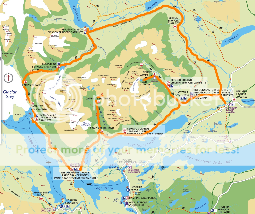
There are generally two hiking routes in Torres del Paine; the W Circuit or the Full Circuit. The first is considered the easier of the two as it takes between 3-7 days depending on your trekking experience, and does a semi circuit of the park, normally started from East to West.
The map of the W Circuit shows the route that this trek takes. takes in the park’s two main valleys; Valle Ascencio on the right (which is where you trek up to the granite ‘torres’, the towers which give the park its name) and Valle Frances in the middle, with the trek to Grey Glacier on the very left of the ‘W’.
See trips that follow the W Circuit:
The Original Torres del Paine W Trek
The Full Circuit starts in the East at the bottom of Asencio Valley and tends to go anti-clockwise round the park. It takes in the less-known, and more rugged areas of the park, following the well-marked path, visiting Lago Dickinson & Glacier Perros, and staying at campsites such as Campamento Serron and Camping Los Perros along the way. It tends to take 10 days to complete and the most difficult part of the Full Circuit trekking through Paso John Garner, a muddy but rewarding trek up to see Grey Glacier.
Trips that take in the Full Circuit:
As a great way to finish your trek, some travellers opt to spend a couple of days kayaking out of the park instead of getting a transfer. The fast-moving Rio Serrano, just to the lake of Lago Toro on the southern boundary of Torres del Paine eventually joins up with Seno Ultima Esperanza or Last Hope Sound, the pretty fjord in the nearest town to the park, Puerto Natales.

