


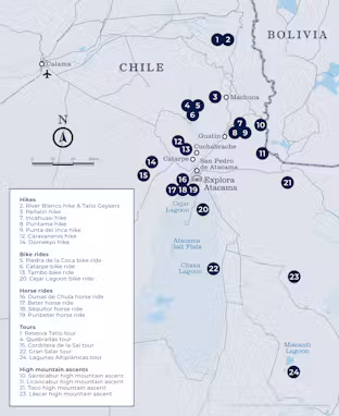
What excursions are available?
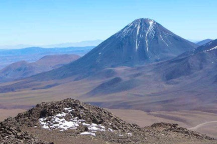
Viewpoint in the Atacama
Atacama Salt Flat
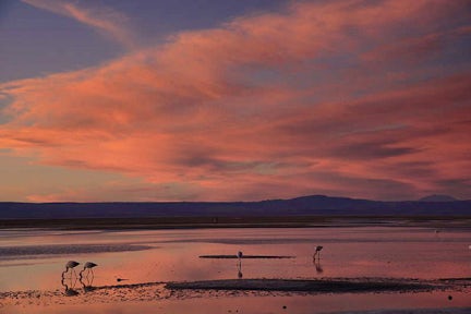
High plain lagoon
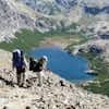
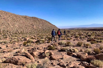
Hikes
2. River Blanco hike & Tatio Geysers
3. Peñaliri hike
7. Incahuasi hike
8. Puritama hike
9. Punta del Inca hike
12. Caravaneros hike
14. Domekyo hike
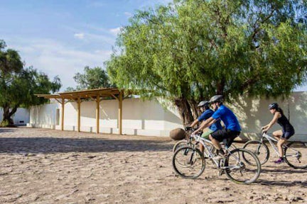
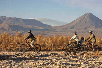
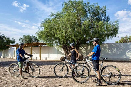
Bike rides
5. Piedra de la Coca bike ride
6. Catarpe bike ride
13. Tambo bike ride
20. Cejar Lagoon bike ride
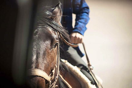
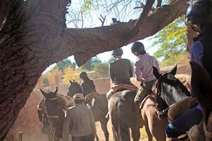
Horse rides
16. Dunas de Chula horse ride
17. Beter horse ride
18. Séquitor horse ride
19. Puribeter horse ride
Tours
1. Reserva Tatio tour
4. Quebradas tour
15. Cordillera de la Sal tour
22. Gran Salar tour
24. Lagunas Altiplánicas tour
High mountain ascents
10. Sairecabur high mountain ascent
11. Licancabur high mountain ascent
21. Toco high mountain ascent
23. Láscar high mountain ascent
1. Reserva Tatio tour
You'll take a van from Explora to the Tatio Reserve and along the way you can take in the Andean plateau fauna, including vicuñas, flamingos, foxes.
You'll walk across the reserve, with views to the Andes Mountain Range, and arrive at the hot water springs and geysers from where steam rises.
You'll return to Explora by van.
Half-day | 5hrs | Walk: 2.4km/1.5 miles | Difficulty: Easy
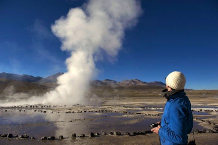
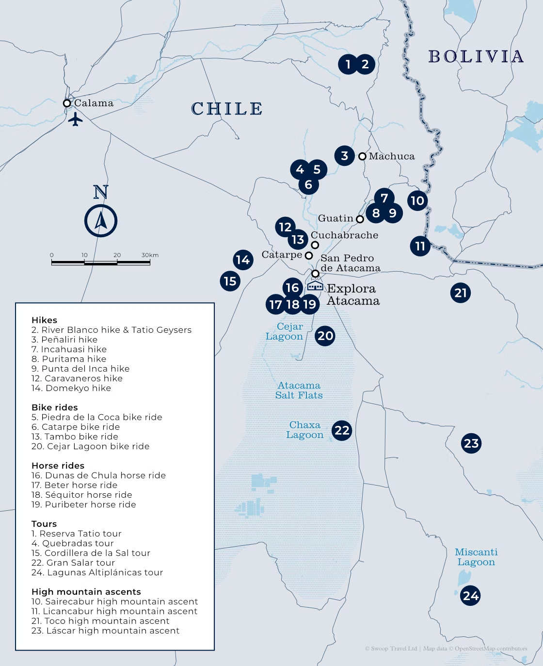
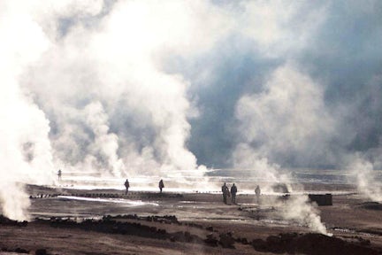
Tatio Geysers
2. River Blanco hike & Tatio Geysers
You'll first take a van north from Explora to the Tatio Geysers. Here you'll walk, following a creek, to reach an little-known warm water river, the Río Blanco.
You'll walk along the bed of the river and come close to geysers and mineral formations unique to geology of this landscape.
Full-day | Trek: 9.2km/5.7 miles, 5hrs | Elevation gain/loss: +31m/-421m | Max/min altitude: 4,408/4,226m | Difficulty: Advanced
Tatio Geysers
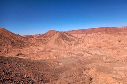
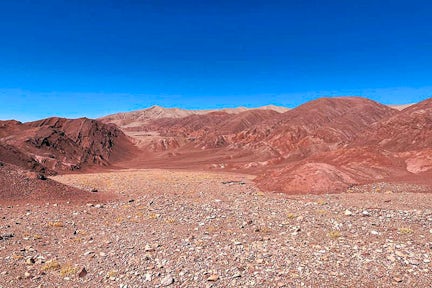
3. Peñaliri hike
You'll first take a van to Machuca, an Andean Plateau village north of Explora. You'll begin by exploring a wetland, then take a walk along a creek to the Río Grande.
On this excursion you'll see native fauna and typical Andean farming terraces.
You'll have lunch at Peñaliri, an abandoned village.
Full-day | Trek: 16km/9.9 miles, 6hrs | Elevation gain/loss: +273m/-1,056m | Max/min altitude: 4,012/3,218m | Difficulty: Moderate
Peñaliri hike
4. Quebradas tour
You'll take a van from Explora to the Yerbas Buenas archaeological site located in the Domeyko Mountain Range.
Here you can see and learn about the different styles of petroglyphs before continuing on to the Rainbow Valley, where the varied colours of the rock walls entice you to walk further into the valley.
Half-day | 4hrs | Difficulty: Easy
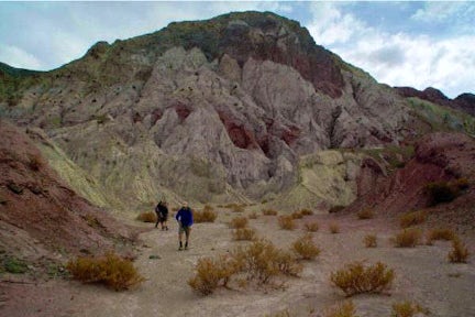
Quebradas tour
5. Piedra de la Coca bike ride
You'll leave Explora by bike and head north to Catarpe on a road that goes to the Salt Mountain Range.
You'll go through an ancient tunnel before starting a descent that will take you to the Piedra de la Coca, an ancient site with petroglyphs.
You ride will continue to the Paciencia Plains through stony terrain and on your way back you'll pass through the Mars Valley.
Half-day | Ride: 32.8km/20.4 miles, 4hrs | Elevation gain/loss: +560m/-560m | Max/min altitude: 2,642/2,431m | Difficulty: Advanced
Piedra de la Coca bike ride
6. Catarpe bike ride
You ride out from Explora to the San Pedro River and then follow its course north to Catarpe.
You'll pass through the Quitor Pukará, an old fortress, and cross the Garganta del Diablo (Devil’s Throat), a canyon inside the Salt Mountain Range with zigzagging paths between striking rock formations.
You'll return to Explora along the same road.
Half-day | Ride: 18km/11.1 miles, 2hrs 30min | Elevation gain/loss: +244m/-244m | Max/min altitude: 2,546/2,431m | Difficulty: Easy
Catarpe bike ride
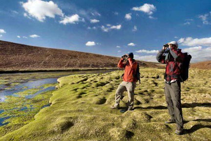
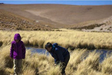
7. Incahuasi hike
You'll start the walk at an old farmhouse at the foot of the volcanoes of the Andes mountain range, north-east of Explora.
From here you'll enter the Jorquencal Gorge where you'll explore the varied vegetation and learn about the history and study of the Andean cat in the Puritama Reserve.
After crossing a varied landscape you'll arrive at the Puritama hot springs where you can relax before returning by van to Explora.
Full-day | Trek: 14.3km/8.9 miles, 6hrs | Elevation gain/loss: +181m/-832m | Max/min altitude: 4,195/3,537m | Difficulty: Advanced
Incahuasi hike
8. Puritama hike
You first take a van to Guatín, north-east of Explora, where you'll begin an ascending walk. After around 30 minutes, passing by giant cacti, you'll arrive at the Puritama River.
From there, you'll descend to walk along the river, through rock walls and vegetation.
You'll finally arrive to the Puritama hot springs were you will have some time to relax.
Half-day | Trek: 5.1km/3.2 miles, 2hrs 30mins | Elevation gain/loss: +327m/-58m | Max/min altitude: 3,538/3,269m | Difficulty: Moderate
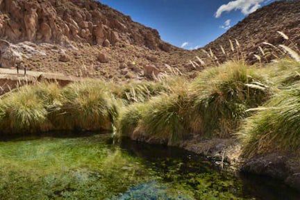
Puritama hike
Swoop says
Explora Atacama offer approximately 50 excursions in the area, many of which are tailored to the groups needs and are available on request.
9. Punta del Inca hike
You'll first take a van north to Guatín, a grazing area and junction of the Puritama and Purifica rivers. It's also the source of the Vilama River.
From there, you'll walk along a canyon known as the 'Valley of the Cacti' due to the proliferation of giant cacti throughout.
You'll cut cross the canyon, crossing the river several times, and descending past a number of different waterfalls.
Half-day | Trek: 3.8km/2.3 miles, 2hrs 40mins | Elevation gain/loss: +84m/-223m | Max/min altitude: 3,205/3,066m | Difficulty: Moderate
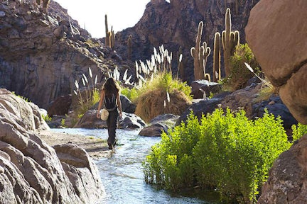
Punta del Inca hike
10. Sairecabur high mountain ascent
After a one-and-a-half hour drive by van from Explora, you'll reach Sairecabur Volcano’s caldera, where you'll begin your ascent.
You'll walk through rocks, stones and loose crags and cross a former sulfur mine before taking on the final steep hike to the summit.
There will be time to take in the views from the top of the 'mountain of rain' before heading back.
Full-day | Trek: 2.4km/1.5 miles, 5hrs | Elevation gain/loss: +294m/-292m | Max/min altitude: 5,984/5,654m | Difficulty: Expert
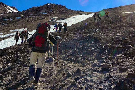
Sairecabur Volcano ascent
11. Licancabur high mountain ascent
Licancabur Volcano ascent
Licancabur Volcano ascent
After having conducted several explorations at altitudes of more than 4,000m to gradually acclimatise your body, you'll leave by van from Explora to a remote camp in Bolivia on the sixth day.
Once settled in at the camp, you'll take a walk across the areas of the Verde and Blanca lagoons, from where there's a good view of Licancabur Volcano. The next day you'll wake up early to begin walking before dawn. You'll use a headlamp to light a well-marked trail.
Halfway along the ascent you'll watch the dawn over the Blanca and Verde lagoons and will reach the summit after walking for several hours.
From here, you'll have a view to the crater and the world’s highest lagoon. The descent can be challenging due to steep slopes and unstable terrain. You'll cross old Inca ruins on the way back.
Note, this expedition requires a minimum stay of seven nights and an advanced exploration request of at least 60 days. A visa is required to enter Bolivia.
Full-day | Trek: 8km/4.9 miles, 11hrs 30min | Elevation gain/loss: +1,298m/-1,295m | Max/min altitude: 5,916/4,623m | Difficulty: Expert
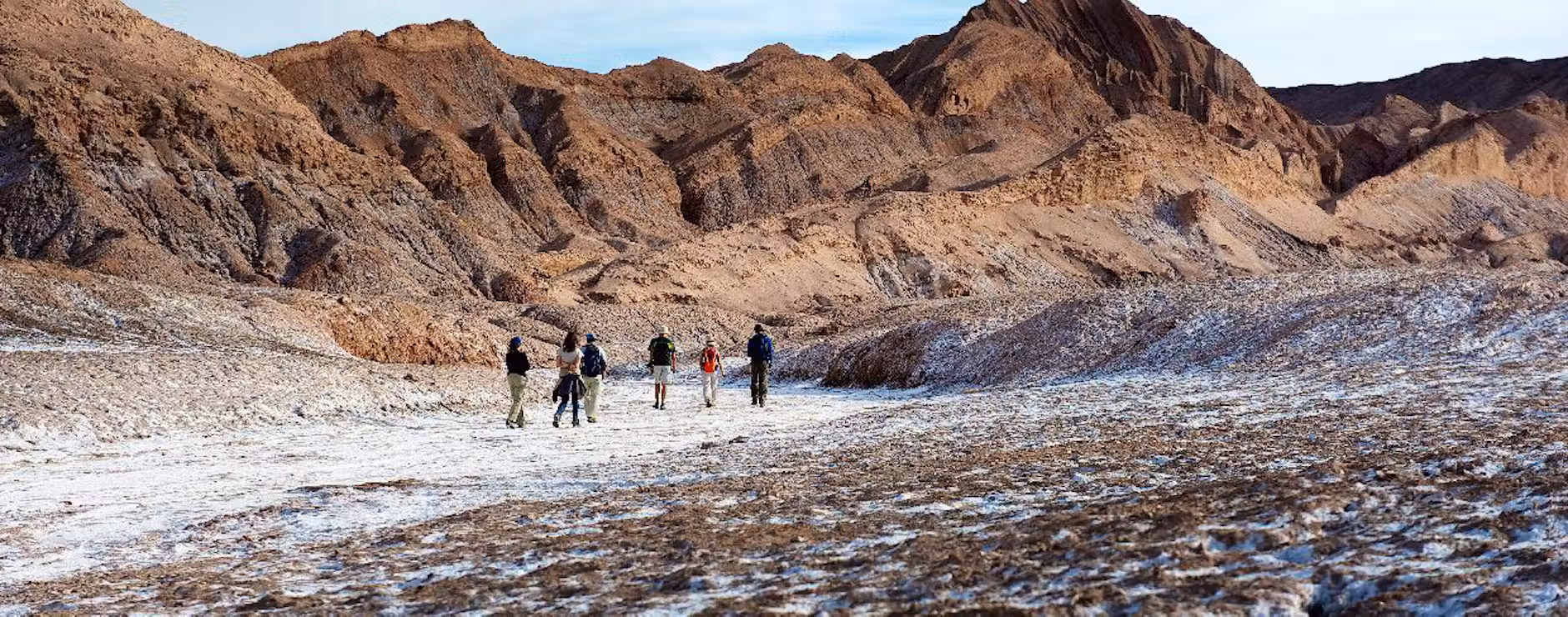
12. Caravaneros hike
This hike takes you on a journey through the history of the old caravans and their interaction with the desert through which they passed.
You'll cross from the Vilama area, north of Explora, toward the Catarpe Valley along old desert trails until reaching the great canyons in Quebrada Chulaco.
This hike offers some fantastic, broad 360° views that really showcase the desert's different terrains and geological formations.
Half-day | Trek: 5.1km/3.2 miles, 2hrs | Elevation gain/loss: +159m/-183m | Max/min altitude: 1,617/2,515m | Difficulty: Easy
Caravaneros hike
13. Tambo bike ride
You'll ride out from Explora, north to the Catarpe Valley.
The route will take you up to Cuchabrache, along an old road that crosses the Salt Mountain Range. Along the way you'll ride through plaster and crystallized salt creeks.
This excursion includes seeing part of the local culture and petroglyphs, as well as the church of San Isidro.
Half-day | Ride: 30km/18.6 miles, 4hrs | Elevation gain/loss: +568m/-568m | Max/min altitude: 2,690/2,431m | Difficulty: Expert
Tambo bike ride
14. Domekyo hike
This hike takes place in the Domeyko Range, to the west of Explora.
You'll hike through great canyons, bursting with colours created by the numerous minerals that make up the terrain. After getting lost between the huge clay walls, you'll descend on some challenging steps - the product of erosion caused by ancient seasonal rivers - on which you'll need to use your hands for grip.
Note that this excursion is not recommended for people with vertigo or fear of heights.
Half-day | Trek: 5.6km/3.5 miles, 3hrs 15mins | Elevation gain/loss: +73m/-292m | Max/min altitude: 2,934/2,715m | Difficulty: Moderate
Domekyo hike
15. Cordillera de la Sal tour
On this excursion, you'll take a van to the Salt Mountain Range to see typical desert landscapes.
There will be open reddish clay grounds, sand dunes, and sedimentary rock formations. You'll walk up to the highest point of this mountain range to see the fantastic panoramic views.
There will also be a 30-minute walk through one the least-known mountainsides of the Salt Ridge.
Half-day | 3hrs 30mins | Difficulty: Easy
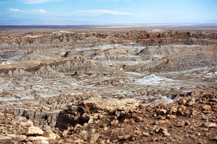
Cordillera del Sal tour
16. Dunas de Chula horse ride
On this excursion you'll ride from Explora to the Salt Mountain Range.
You'll cross the San Pedro River and sand dunes, from where you'll have panoramic views of the Andes Mountain Range and the oasis.
Following this, you'll follow a dry riverbed before making your way back to Explora through the pampa.
Half-day | Ride: 9.2km/5.7 miles, 2hrs 30min | Elevation gain/loss: +114m/-114m | Max/min altitude: 2,481/2,410m | Difficulty: Easy
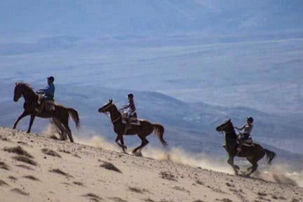
Dunas de Chula horse ride
17. Beter horse ride
On this excursion, you'll visit two ayllus, ancient Atacameño farm communities, where you can see local lifestyle, vegetable gardens and archeological remains.
The first ayllu is Solor, followed by the ayllu dunes of Beter, one of the first Atacameño settlements.
Note, this is for experienced and advanced riders who have mastered rising trot and canter over uneven terrain in open spaces and on all types of horses. A test in the hotel is required before going out into the desert.
Half-day | Ride: 11km/6.6 miles, 3hrs | Elevation gain/loss: +106m/-106m | Max/min altitude: 2,431/2,388m | Difficulty: Advanced
Beter horse ride
18. Séquitor horse ride
On this excursion, you'll ride to the ayllus located in Séquitor, Yaye, and Checar - all Atacameño social and farming communities that are also considered small oases in the middle of the desert.
Here, vegetable gardens are still common and traditional Atacama construction techniques using adobe and straw roofs is prevalent.
Half-day | Ride: 7.6km/4.7 miles, 1hr 45mins | Elevation gain/loss: +42m/-42m | Max/min altitude: 2,431/2,410m | Difficulty: Easy
Séquitor horse ride
19. Puribeter horse ride
You'll leave Explora on horseback and head south to the Beter ayllu, where you'll learn about its history and archaeological ruins.
You'll then continue towards the Puribeter Reserve, a site that preserves the nature and culture of the San Pedro de Atacama oasis area.
Here you'll enjoy lunch and a walk in the park before continuing on horseback to the Solor ayllu and finally back to Explora.
Full-day | Ride: 23km/14.3 miles, 5hrs | Elevation gain/loss: +133m/-132m | Max/min altitude: 2,431/2,384m | Difficulty: Advanced
Puribeter horse ride
20. Cejar Lagoon bike ride
You'll leave Explora by bike and head south, crossing different ayllus (old social and agricultural communities) to enter the northern part of the Atacama Salt Flat and reach one of its first lagoons, Laguna Cejar.
Here you'll have time to bathe in one of the lagoons before returning to Explora.
Half-day | Ride: 18.1km/11.2 miles, 2hrs | Elevation gain/loss: +42m/-126m | Max/min altitude: 2,431/2,339m | Difficulty: Easy
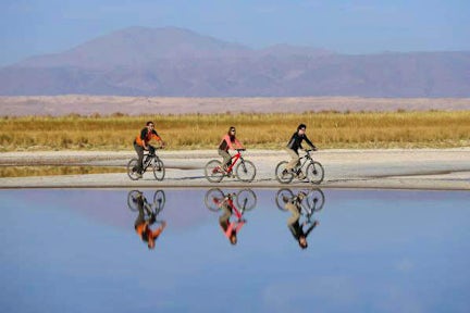
Cejar Lagoon bike ride
21. Toco high mountain ascent
You'll leave Explora by van and head to the Andes Mountains, an hour away, where you'll begin your ascent.
You'll take a steep trail up to the summit with views to Bolivia, Argentina, and the surrounding volcanoes.
This is an ideal introduction to high mountain ascents.
Half-day | Trek: 5.7km/3.5 miles, 4hrs | Elevation gain/loss: +520m/-520m | Max/min altitude: 5,610/5,086m | Difficulty: Moderate
Toco Volcano ascent
22. Gran Salar tour
On this excursion, you'll leave Explora in a van for Toconao, located to the south of San Pedro de Atacama.
Here you can walk to the village square and through some vegetable gardens before taking the van to the Chaxa Lagoon, located in the Los Flamencos National Reserve.
This is an ideal place for bird watching on the Atacama Salt Flat.
Half-day | 4hrs 30mins | Walk: 2.1km/1.3 miles | Difficulty: Easy
Gran Salar tour
23. Lascar high mountain ascent
You'll take a van from Explora for two hours to enter the altiplano of the Andes Mountain Range.
At the base of the active Láscar Volcano you'll begin your ascent through a soft terrain, climbing gradually.
At the summit you'll have superb wide views of different volcanoes and the Salar de Atacama basin.
Full-day | Trek: 5.3km/3.3 miles, 5hrs | Elevation gain/loss: +594m/-594m | Max/min altitude: 5,592/5,006m | Difficulty: Moderate
Láscar Volcano ascent
24. Lagunas Altiplánicas tour
You'll leave Explora by van and head to the southern area of the salt flat, from where you'll begin climbing the slopes of the Andes mountain range. Your first stop will be in the town of Socaire, after which you'll continue towards the Piedras Rojas area in the Aguas Calientes salt flat.
Here you'll take a short walk with incredible views of the volcanoes and the salt flat before continuing towards the high plateau lagoons of Miscanti and Miñiques, two large and beautiful bodies of water located at an altitude of 4,200m. You'll enjoy a walk surrounded the contrasting blue of the water and the reddish mountains of the high plateau.
You'll continue onwards to your lunch spot, after which you'll return to Explora.
Full-day | 7hrs | Difficulty: Easy
Lagunas Altiplanicas tour