


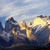
Volcán Lonquimay
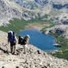
The reserve's focal point. Slightly northeast of town, it dates from the late Pleistocene but erupted as recently as 1933, almost simultaneously with nearby Volcan Llaima, and lava flows spilled down its northestern flanks in 1990. Trails to nearby Cerro Cautin (2.5 hours) and Lonquimay's summit start here, and Sendero de Chile rounds Lonquimay before decending into town and then continuing toward the Sierra Nevada and Conguillo; a new trekking map, for sale at La Suizandina will make hiking here easier.
2,865 m (9,400 ft)
Map of Volcán Lonquimay
Nearby landmarks
