


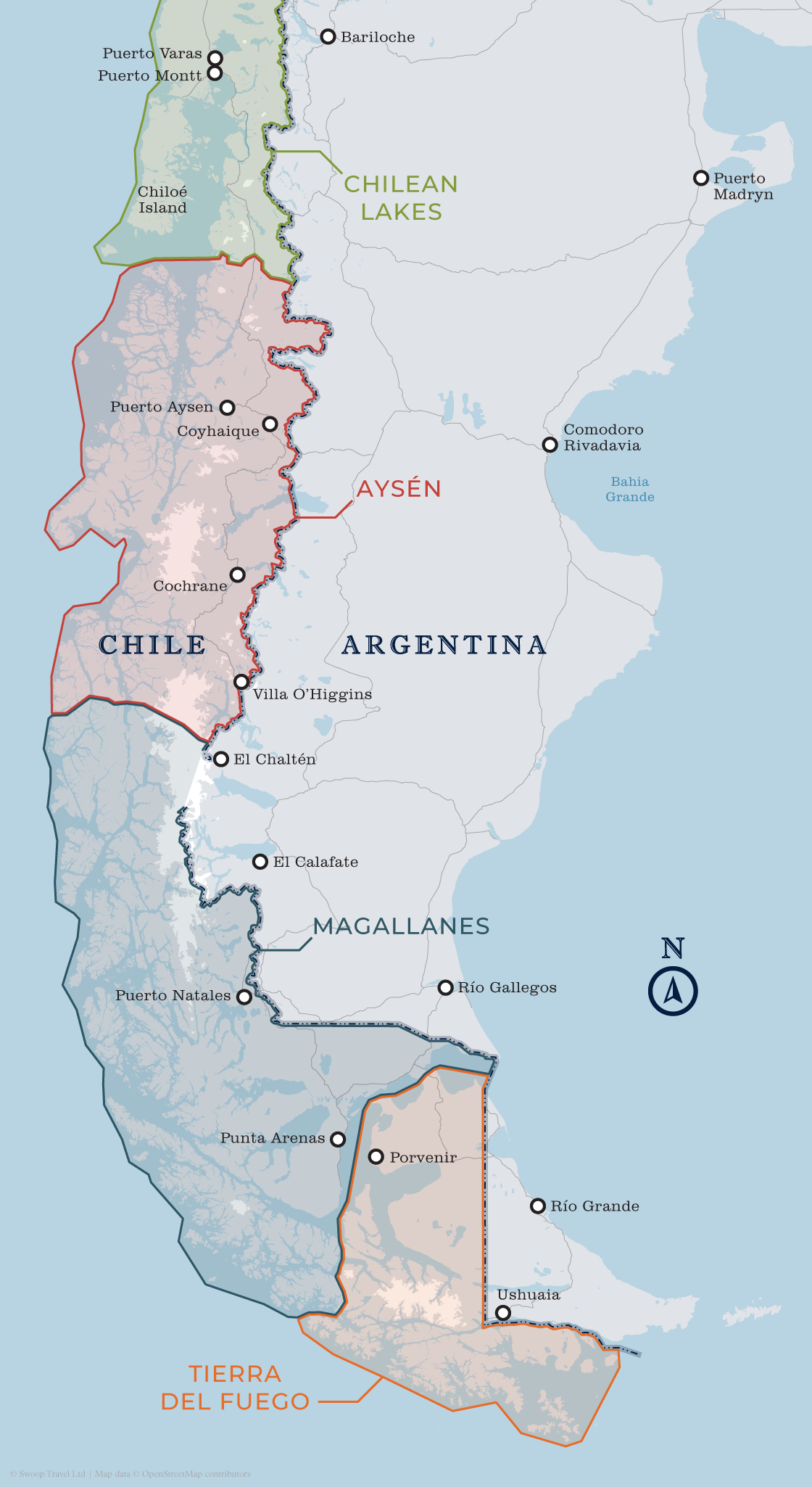


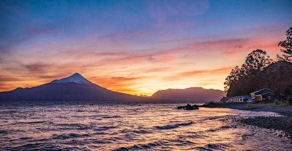
Chilean Lake District
The Chilean Lake District is packed with glacial lakes, snow-capped volcanoes, islands rich in history and folklore, national parks and adventure sports activities.
Discover More
The Route of the Parks starts at the gateway to both the Andes Mountains and the world famous Patagonian Fjords. From here, you travel south into the region of the Chilean Lakes, where the evergreen forests and elegant waters stretch for miles.
The route then takes you into Aysen, where you can find spectacular fjords, jagged rock walls and magnificent glacier waterfalls. The temperature slowly drops as you travel further south and immense glaciers and snowdrifts begin to appear.
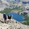
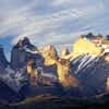
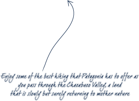
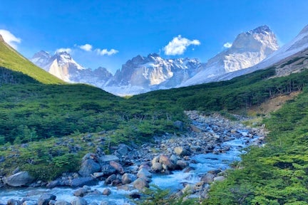
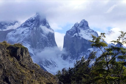
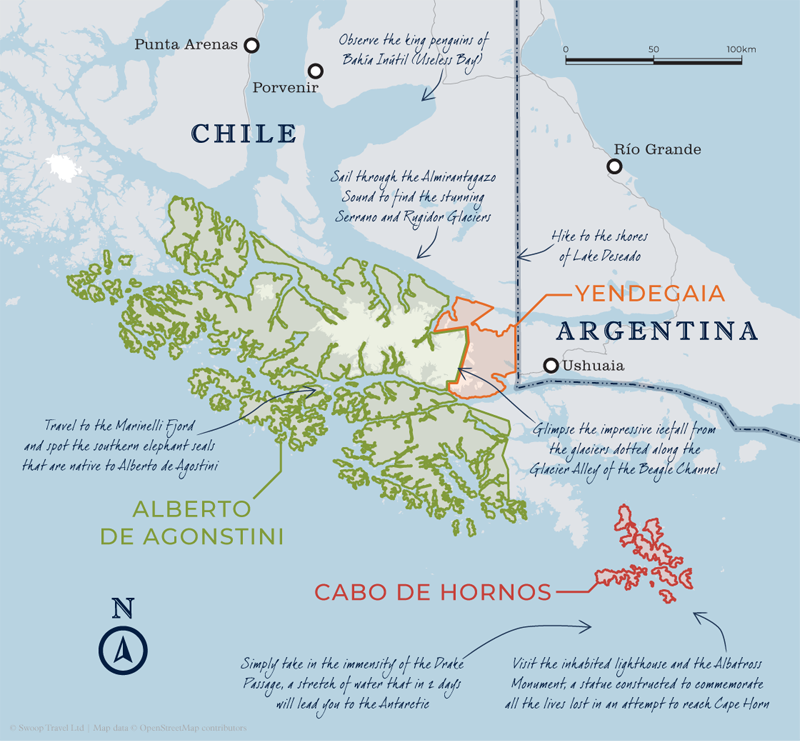
In Magallanes, the Torres del Paine region is home to a range of towering, snow-capped mountains sharply contrasted with turquoise lakes and pristine glaciers. The massif is home to some of the best trekking not only in Patagonia but in the entire world.
Finally, you reach the Tierra del Fuego where you are transported to a landscape of cold desert, tundra that gives way to dense evergreen vegetation and immense unexplored mountain peaks and glaciers. The only point in the world where the waters of the Pacific and Atlantic Oceans meet – you have truly reached the end of the world.
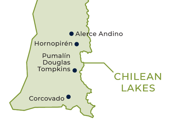
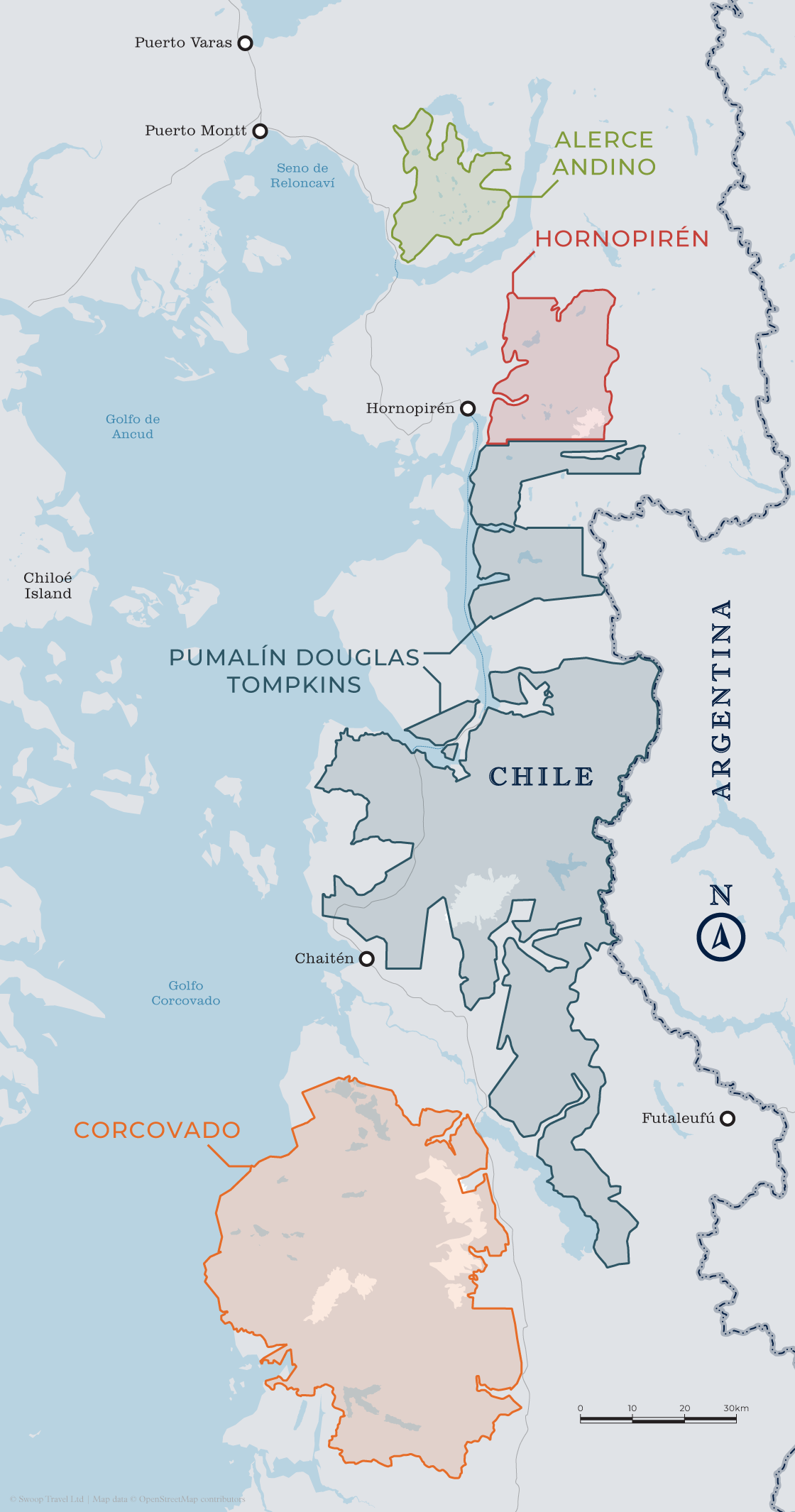
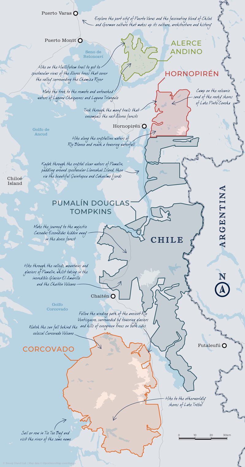
The Chilean Lakes region is mainly made up of numerous accessible protected areas, with the Route of the Parks primarily consisting of two: Pumalín Douglas Tompkins and Alerce Andino, which were founded in 2018 and 1982 respectively. Home to incredible flora, fauna and vast lakes that are surrounded by ice-capped volcanic calderas, Los Lagos has it all, and is the vibrant gateway into wider Patagonia.
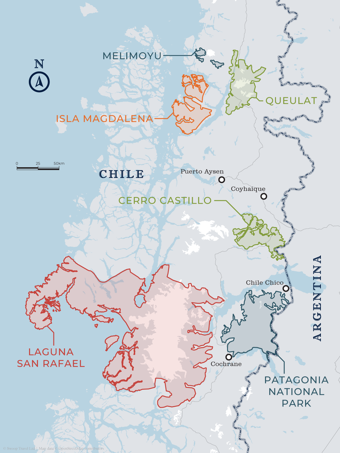
With most of the parks that make up Aysen only opening to the public in the past few years, this stretch of the Route of the Parks is perfect for lovers of pure wilderness and absolute untouched nature.
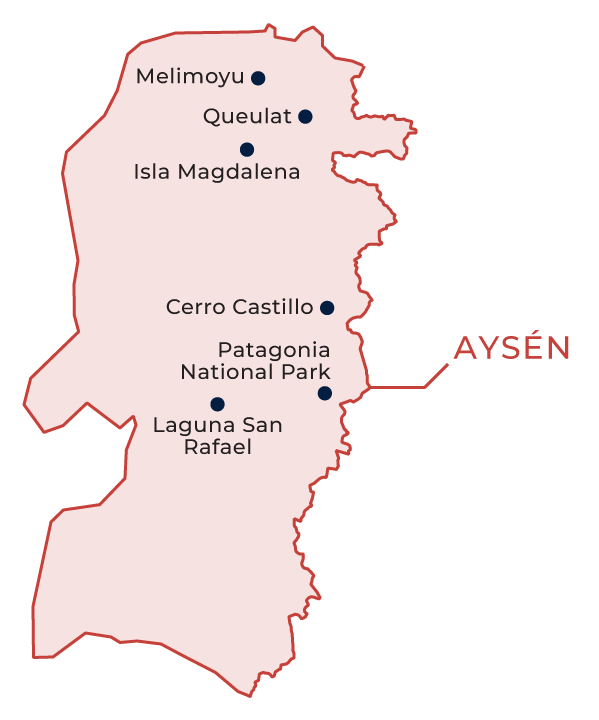
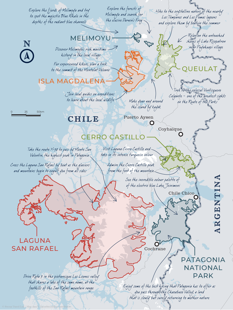
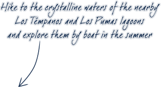
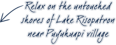
Aysen is primarily made up of the national parks of Laguna San Rafael, Patagonia and Queulat, all of which are very distinct from each other.
From the arid Patagonian steppe to the mosaic of snowy icefields explored by Charles Darwin, the Aysen region has it all.
The Route of the Parks was created in 2018 after the Tompkins Conservation made the largest private donation of land to a country ever: seventeen national parks making up over one million acres of land were handed over to the Chilean government.
Sydney Miller Patagonia Specialist
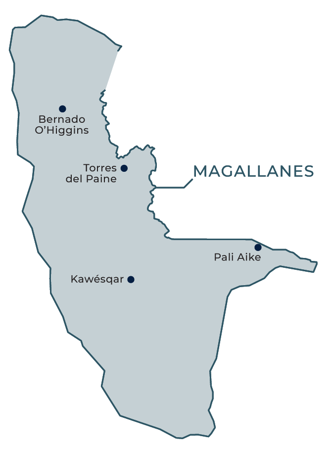
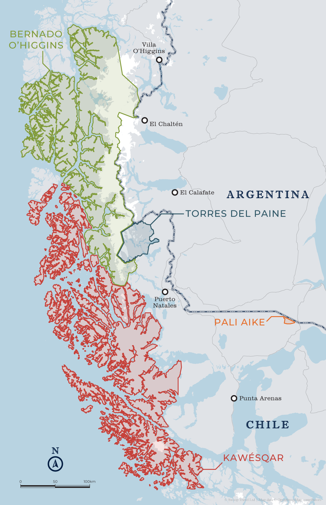
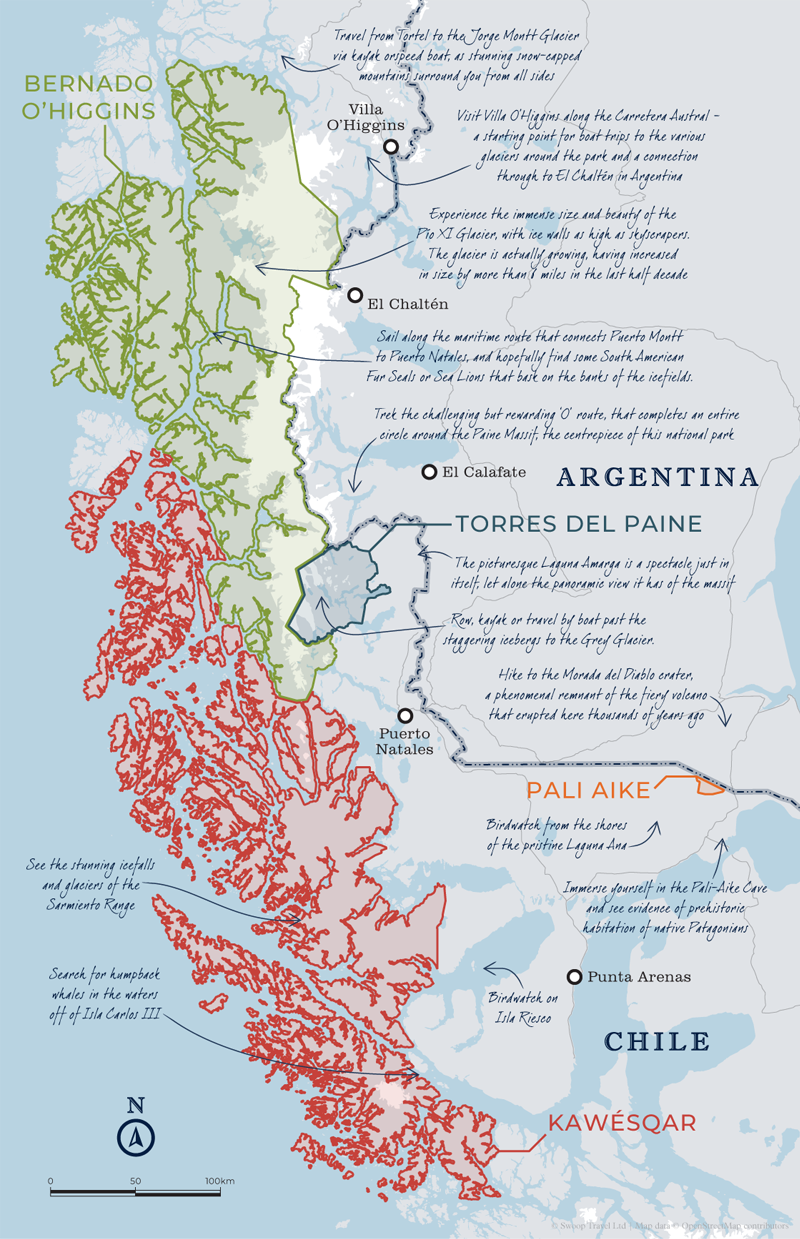
As the terrain becomes more mountainous and the temperature drops, the Magallanes region offers travellers of the Route of the Park a plethora of new sights, sounds and experiences. The region is mainly made up of the Bernardo O’Higgins and Torres del Paine national parks.
Bernardo O’Higgins is simply vast – it’s the largest national park in Chile by area, and one of the largest in the world.
Torres del Paine is declared the ‘Eighth Wonder of the World’ by many, and the Paine Massif is perfect for trekking and climbing enthusiasts.
The mission of the Route of the Parks is to preserve and support the cultural and geographical heritage of Chilean Patagonia, whilst also boosting economic vitality on a local level through tourism as a result of this conservation. Also to instil the significance of the route as a ecological lifeline for our planet in the face of climate change and the rapid decline in global biodiversity.
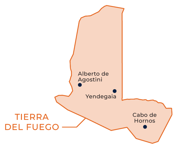
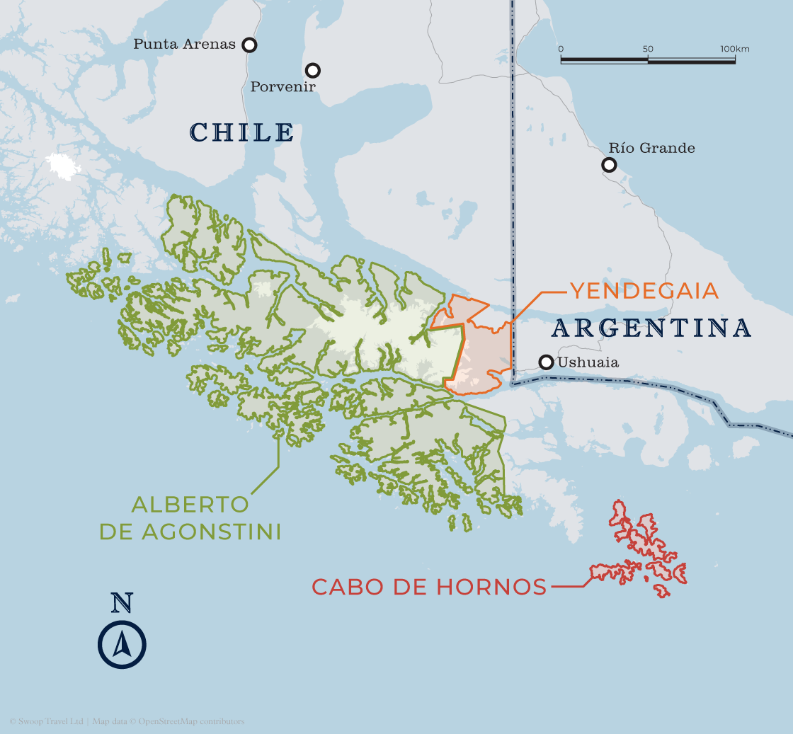
As you approach the Antarctic Circle, the landscapes become other-worldly. The Tierra del Fuego, or ‘Land of Fire’, region consists of the Pali Aike, Alberto de Agostini and Cabo de Hornos national parks.
From volcanic deserts to evergreen forests to majestic fjords and vast, open seas, when you reach the Tierra del Fuego region, you have truly reached the end of the world.
This region is even more rugged and wild than those that came before it and is an explorer’s paradise.


The famous trails of Torres del Paine and Los Glaciares are well marked and well suited to independent hiking for those with experience. Guides can help you access the more remote and lesser known spots that in many cases are equally dramatic.
Having spoken to over a thousand people who have visited the region, our view is that guides bring so much more than safety and navigation - a richer awareness of the region's wildlife, ecology, history, and cultural identity.
For those on a tight budget, self-guided hikes on the main trails of Torres del Paine and Fitz Roy will be a tremendous experience. Those who are experienced and fiercely independent might do well to mix some guided days with some independent days.
Visit our hiking page for more juicy details on the best hiking in Patagonia.
The main trekking season runs from November to March in most destinations. This is when most of the facilities are open, buses are running and the weather is at its best. If you want to see the spring flowers and more snow on the peaks then November is a beautiful time to go. For the Autumn colours then consider late March and early April. Snow and ice conditions for mountaineering and ice cap expeditions will be best from November to January.
Patagonia is a popular destination, and especially so mid-December to mid-January, so if you want to hike the most famous routes then try to visit outside the busiest period, or consider the more off-the-beaten-track routes at this time of the year.
It is possible to trek all year round? Winter in Patagonia (May - August) offers less daylight and colder temperatures. In the Chilean Lake District and Tierra del Fuego there's a lot of rain however in the south and east of Patagonia there's generally less rain and visibility can be better than the peak of summer.
Head over to our when to visit page for more information.
By leaping on a horse or into a kayak you can get truly off the beaten track.
If you are really intrepid you might consider sailing through the Patagonian Fjords and using the boat to access some fantastic remote hiking.
The only toilets are at the refugios and campsites so you need to be prepared to go for wild toilet stops.
The highest peak in Patagonia is 4058m (13,314ft) high and most of the trails don't go higher than 1,500m (4,920ft) so you don't need to acclimatise when you go hiking in Patagonia.
Typically a guided, fully supported trek (with enough porter support that you just carry your own gear including sleeping bag and sleeping mat or hut accommodation) costs US$300-350 per person per day. Self guided treks will be cheaper and hiking from a luxury hotel will be 2 or 3 times more expensive. There are regional differences in costs so if you find Torres del Paine very expensive then have a look at Tierra del Fuego or Aysen.
The Chilean Lake District is packed with glacial lakes, snow-capped volcanoes, islands rich in history and folklore, national parks and adventure sports activities.
Discover More
Argentina's Los Glaciares is full of jagged granite mountains, electric-blue lakes and sparkling glaciers: perfect for anything from short day hikes to epic wilderness treks.
Discover More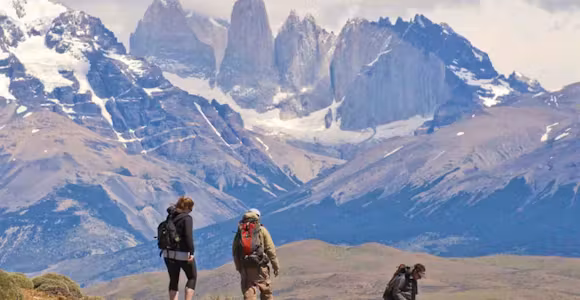
The W Trek is Torres del Paine most famous hiking route, which can be walked in a variety of ways, from a multi-day trek to a series of day hikes.
Discover More
Cape Horn is South America’s final lonely outpost in the ocean. Shrouded in the myth and romance of the sea, it’s accessible only by adventure cruise ship.
Discover More